Up at 6:00 AM for a sunrise cruise aboard the panga around Kicker Rock - formally Leon Dormido. A volcanic tuff column that has split in two, I'd guess it is 400 feet tall, a pair of vertical columns standing out of the ocean. Looking at some of the cracks and tunnels, it will be splitting into three pieces before too long.
It's also a rookery for thousands of seabirds, with the different zones of the rock supporting nests of different species. Down low are Blue-footed Boobies nesting on improbably small rock ledges; larger nooks down low have Swallow-tailed Gulls and a few Lava Gulls. Up where it is slightly flatter there are Masked Boobies. In the few places where there is scrub brush there are frigatebird nests, but in the low light and bad angle we couldn't tell which species.
After Kicker Rock, we motored to Puerto Baquerizo Moreno in Wreck Bay, at the westerly end of San Cristobal Island, the administrative capital of the Galapagos Islands. After some initial confusion about which bus and which driver, we motored toward Laguna El Junco. About 2.5 kilometers out of town, we walked a stretch of the old highway between Baquerizo and El Progresso, with great success. In particular, the San Cristobal Mockingbird, a Warbler Finch, a Vegetarian Finch and a Woodpecker Finch. The lake itself - the only fresh water body on the island - is at about 700 meters, and lies in a cinder cone crater. The air was misty with moisture condensed from the trade winds. The mist is locally called guara, and for a bunch of Alaskans El Junco was the coolest, most comfortable air of the trip. We walked the rim of the lake, probably less than a kilometer altogether, to the chagrin of Desiree.
The water of the lake is mineralized, but not too badly to keep away White-cheeked Pintail, Common Moorhen and Black-necked Stilt. The Park has made massive efforts around the lake to root out the alien blackberry and replace it with native plants.
The zones on San Cristobal, at least along the road to El Junco, are particularly dramatic. There is a band of green, salt-tolerant plants along the littoral zone, then near-desert through the arid zone, then a transition zone, then a scalesia zone (after the plant), and then, at least on the windward side, the miconia zone. San Cristobal is too low to have the highest zone, the fern and grass zone; El Junco sits at the top of the miconia zone. Each zone has its own, very different, vegetation.
On the way back, we stopped at an overlook outside of El Progresso. So-so, there were views west to Baquierzo.
In the afternoon, we visited the new Interpretative Center. A nice effort, with an environmental message that's almost at the propaganda level. On the other hand, two escaped goats can work devastation.
This is very much a government town. Most vehicles have some government agency name stenciled on the side. Desiree reports there is a kind of inferiority complex with shades of resentment at the success of Puerto Ayora over on Santa Cruz.
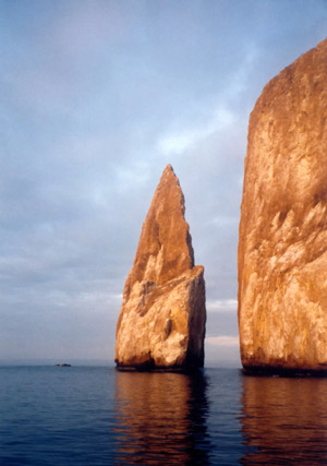
Kicker Rock, showing the split in the islet
San Cristobal Island
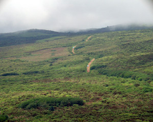
The road to Laguna El Junco, climbing through the miconia zone. Note there is some agriculture.
San Cristobal Island
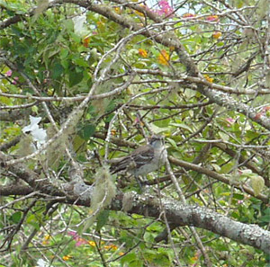
San Cristobal Mockingbird
San Cristobal Island
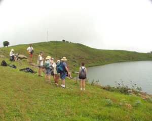
Laguna El Junco
San Cristobal Island
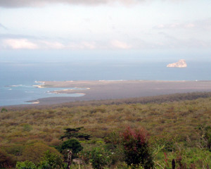
Looking NE from El Junco; Kicker Rock is to the center right
San Cristobal Island
|
Birds
|
Others
|
| Great Frigatebird Masked Booby Swallow-tailed Gull Blue-footed Booby Red-tailed Tropicbird Medium Ground Finch Lava Gull Brown Pelican San Cristobal Mockingbird Cattle Egret Small Ground Finch Warbler Finch Vegetarian Finch Yellow Warbler Smooth-billed Ani Woodpecker Finch Small Tree Finch Common Moorhen White-cheeked Pintail Black-necked Stilt |
Lava Lizard Marine Iguana Galapagos Sea Lion Sally Lightfoot Crab |